
The Estrada Real
History
The Estrada Real is the largest tourist route in the country. It extends over 1,630 kilometers, passing through Minas Gerais, Rio de Janeiro and São Paulo. Today, it rescues the traditions of the route by valuing the region's identity and beauties.
Its history dates back to the mid-18th century, when the Portuguese Crown decided to make official the routes for the transit of gold and diamonds from Minas Gerais to the ports of Rio de Janeiro . The trails that were delegated by royalty gained the name of Estrada Real.


Signaling
On the main axes of the paths – Velho, Novo, dos Diamantes and Sabarabuçu – there are landmarks on the Estrada Real. trail.
So you don't get confused, here are some tips: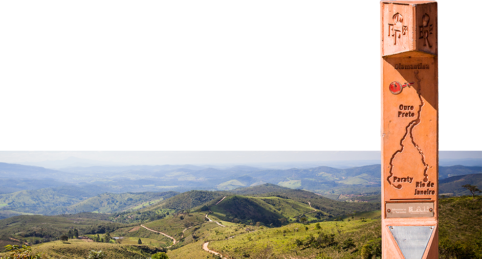
Institutional
Created in 1999, the Estrada Real Institute aims to organize, promote and manage the Estrada Real tourist product. The Institute is linked to the FIEMG System and has a multidisciplinary team, which has made the destination recognized in Brazil and in the world.
Nós usamos cookies e outras tecnologias semelhantes para melhorar a sua experiência em nossos serviços, personalizar publicidade e recomendar conteúdo de seu interesse. Ao utilizar nossos serviços, você concorda com tal monitoramento. Informamos ainda que atualizamos nossa Política de Privacidade.